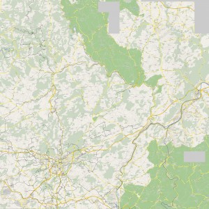
Bicycle friendly routes in Luxembourg
Here’s the second revision of the Luxembourg unofficial Cycling friendly routes map. A few routes are still missing and need to be added, which will be done in the future, as usual.
In addition, the map may be viewed using Google Maps here. Tracks resolution had to be reduced but this inconvenient will be fixed soon; another work is in progress.
A bicycle friendly route is either an official cycling route, a rural road where only tractors and bicycles are allowed, some good quality tracks (mapped only when an area doesn’t have any other choice), very low traffic roads and rarely roads when they are convenient to merge two other sections as long as traffic is not high.
The map has been done with Viking, a free/open source program to manage GPS data. The work file may be downloaded here.
If anybody interested in more detailed roads until I write a download and/or zoom script, please contact me and I’ll send you my GPS log files (in GPX format).
You may want to visit GPSies, a community for vagabonds with their GPS.
Update in 2012
As an active OpenStreetMap contributor, I added all the ways which were missing, so they are now on the Cycle Map.

Hi there!
I would like to have a copy of your map of cycling roads in Luxembourg, if you be kind to send me one? (:
Kind regards, Ann Catrine
Dear Ann Catrine,
Thank you for your message, it was a nice trigger, I updated the map and made it bigger.
Best!
Tristan