Bonjour, Goodbye: A Strange iTerm2 Networking Bug

From time to time, I experienced strange behaviour in my programs and scripts running on my Mac. They became unable to connect to some hosts on my local network: only some, not all. This caused failures in my photo-processing scripts and data backups, and it seemed to happen after something was triggered on the system.

Most of the error messages were network-related, such as “No route to host”.

Connecting to my local API server using curl (or a Python script) didn’t work, but it worked in my browser.

Tired of my scripts and backups failing randomly, I investigated what might be happening. I had a workaround, but it required running those scripts after opening an SSH session to localhost (or running everything as root…).

And it happened again, so I went down the rabbit hole. (Spoiler: a self-upgrade likely triggered it.)

The mystery: two hosts, one subnet, different outcomes

I couldn’t directly connect to a host named pdp17 except when running it via a local SSH session, while I could connect to one called cosmos.

pineapple:~ kewl$ ping -c 1 pdp17 ; ssh localhost ping -c 1 pdp17
PING pdp17.in.eo.lu (10.31.33.23): 56 data bytes

--- pdp17.in.eo.lu ping statistics ---
1 packets transmitted, 0 packets received, 100.0% packet loss
(kewl@localhost) Password:
PING pdp17.in.eo.lu (10.31.33.23): 56 data bytes
64 bytes from 10.31.33.23: icmp_seq=0 ttl=64 time=0.498 ms

--- pdp17.in.eo.lu ping statistics ---
1 packets transmitted, 1 packets received, 0.0% packet loss
round-trip min/avg/max/stddev = 0.498/0.498/0.498/0.000 ms
pineapple:~ kewl$ arp -an | grep 10.31.33.23
? (10.31.33.23) at bd:14:41:f1:42:42 on en11 ifscope [ethernet]
pineapple:~ kewl$ ping -c 1 cosmos
PING cosmos.in.eo.lu (10.31.33.5): 56 data bytes
64 bytes from 10.31.33.5: icmp_seq=0 ttl=64 time=0.356 ms

--- cosmos.in.eo.lu ping statistics ---
1 packets transmitted, 1 packets received, 0.0% packet loss
round-trip min/avg/max/stddev = 0.356/0.356/0.356/0.000 ms

Eliminating the usual suspects

Maybe it’s related to the system environment, so I compared the environments in the SSH and local sessions. Nothing relevant.

DNS resolution? Nope.

ARP, routing and interface selection? Nope.

Running tcpdump while pinging revealed that the echo request was sent and its reply received, despite the packets being reported as lost.

The permissions paradox

But in the same shell, running sudo ping pdp17 worked.

I opened Terminal.app (instead of iTerm2), and I could ping pdp17 there.

Maybe that macOS Privacy and Security feature for the Local Network? That could explain why root can connect, and also why it works when run via SSH, since the SSH daemon’s parent is launchd. More information here; the relevant notes are:

macOS maintains separate local network privacy state for each user account.

macOS automatically allows local network access by:

  • Any daemon started by `launchd`
  • Any program running as root
  • Command-line tools run from Terminal or over SSH, including any child processes they spawn

important: The exception for `launchd` daemons doesn’t apply to `launchd` agents. If you’re building a `launchd` agent, see the discussion below.

But why would it work on some hosts on the same network? Anyway, it was permitted in System Preferences. Same verification with the firewall rules: there were none.

The breakthrough: Unified Logging

I checked Unified Logging while trying to connect in another session:

pineapple:~ kewl$ sudo log stream --style compact --info --debug  --predicate 'subsystem == "com.apple.networkextension"'
...
2026-11-18 14:03:37.774 I UserEventAgent[115:24bd5f] [com.apple.networkextension:] Got local network blocked notification: pid: 1711, uuid: 44250719-9DD6-396A-B5CD-51BFAD462FFE, bundle_id: (null)  
2026-11-18 14:03:37.774 E UserEventAgent[115:24bd5f] [com.apple.networkextension:] Failed to get the signing identifier for 1711: No such process  
2026-11-18 14:03:37.774 Db UserEventAgent[115:24bd5f] [com.apple.networkextension:] Signing identifier cache miss for 44250719-9DD6-396A-B5CD-51BFAD462FFE  
2026-11-18 14:03:37.774 I UserEventAgent[115:24bd5f] [com.apple.networkextension:] LocalNetwork: did not find bundle ID for UUID 44250719-9DD6-396A-B5CD-51BFAD462FFE  
2026-11-18 14:03:37.774 E UserEventAgent[115:24bd5f] [com.apple.networkextension:] Failed to find bundle ID, ignoring

PID 1711 no longer existed when I checked, and macOS couldn’t determine its signing identifier or associate it with an application bundle. Could a process have died? So it’s a process that isn’t allowed to connect, and it’s not iTerm2.

I later wanted to investigate what this PID could be, and my assumption that it wasn’t iTerm2 was both right and wrong: it was the PID of iTerm2 before it self-updated, and ended up with helper processes from versions 3.7.6 and 3.7.7 running simultaneously. Also, the bundle 44250719-9DD6-396A-B5CD-51BFAD462FFE?

I investigated the UUID reported in the Local Network blocked notification: 44250719-9DD6-396A-B5CD-51BFAD462FFE, and after discovering that components from both iTerm2 3.7.6 and 3.7.7 were still running, I checked the old application’s executable in my backup using dwarfdump –uuid, and it was a match!

When different tools disagree

Establishing the connection with netcat worked, but not with telnet:

pineapple:~ kewl$ nc -v pdp17 22
Connection to pdp17 port 22 [tcp/ssh] succeeded!
SSH-2.0-OpenSSH_10.0p2
^C
pineapple:~ kewl$ telnet pdp17 22
Trying 10.31.33.23...
telnet: connect to address 10.31.33.23: No route to host
telnet: Unable to connect to remote host

telnet is installed from Homebrew, but nc comes with the OS. I also inspected their code signature, which was irrelevant (the command used was: codesign -dv --verbose=4 "$(command -v nc)" 2>&1 ; replace nc with telnet and ssh)

Another interesting pattern was when forcing IPv4: ssh -4 pdp17 led to a stalled socket that didn’t time out for several minutes, but running ssh -4 10.31.33.23 connected to the host.

 SSH itself had another strange error; while most tools returned “No route to host”, SSH had its own message, which is quite obscure.

pineapple:~ kewl$ ssh pdp17 id
ssh: connect to host pdp17 port 22: Undefined error: 0

 But where it got interesting is when I added an argument to ssh, it connected:

pineapple:~ kewl$ ssh -o ConnectTimeout=3 pdp17 id
uid=1000(kewl) gid=1000(kewl) groups=1000(kewl),27(sudo),100(users)

 OpenSSH’s options affect the connection behaviour. It may change the connection to use non-blocking sockets.

And I found this web page where someone had a similar problem, where they mention:

So the evidence points to the blocking connect() to these mDNS-resolved IPv6 addresses failing on current macOS build, while the non-blocking path works. This could be a bug in this macOS build’s handling of mDNS-resolved scoped addresses, or something in the Local Network privacy layer.

The unexpected fix: disabling Bonjour in iTerm2

That blog post invited me to look towards mDNS. So I tried disabling Bonjour in iTerm2’s Magick settings. Then I opened a new tab, and it just connected.

I found a workaround which doesn’t require me to change my process, but it’s not the root cause.

One final observation

Disabling Bonjour in iTerm2 restored connectivity, but that doesn’t necessarily mean Bonjour was the problem.

After the troubleshooting session, I looked deeper into Unified Logging and found the UUID in macOS’s Local Network blocked notification matched the executable from the previous version of iTerm2, which I had upgraded the day before. Components from both versions were still running.

I suspect that the update left some stale application identity or network permission state, possibly interacting with iTerm2’s Bonjour integration, but it’s only a hypothesis.

So, maybe Bonjour was the trigger, the workaround reset something, or the two observations are related in another way.

One other detail I remembered after I wrote this text: I also disabled Wi-Fi to use my wired Gigabit Ethernet connection. That may have triggered a network-interface change while iTerm2 was running, possibly affecting Bonjour discovery or macOS’s Local Network privacy state. So the self-upgrade wasn’t necessarily the only trigger.

Below are the versions I used:

  • iTerm2: Build 3.7.7, but components of 3.7.6 and and 3.7.7 ended up running simultaneously.
  • macOS: Darwin pineapple 25.6.0 Darwin Kernel Version 25.6.0: Mon Oct 12 00:33:09 PDT 2026; root:xnu-12377.161.15.701.48~2/RELEASE_X86_64 x86_64
  • OpenSSH: OpenSSH_10.5p1, LibreSSL 3.3.6

The investigation was done on November 18, 2026.

What this taught me

The Network is the Computer, and the terminal emulator has opinions about both!

Subharmonic Playground

A trance through ancient rhythms and digital wonderlands: didgeridoo drones meet toy piano lullabies in this earthy, synthetic dreamscape.

This track is licensed under Creative Commons Attribution 4.0 (CC BY).
You’re free to remix, share, perform, and use this track, even commercially, as long as you credit me.
You may not claim exclusive rights or collect royalties for this track or derivative works.

Sequoia’s 100,000 km

Sequoia has hit 100,000 km on April 26! To celebrate, Nadia planned the perfect route leading to one of best spot in the country, surrounded by the most beautiful sheep when it hit exactly that distance. She even baked an excellent carrot cake for the occasion.

We spent a fantastic time together in the Mullerthal area. The scenery was lovely, and the company was even better. The only downside was the rain towards the end, but the darkening clouds were a warning.‍

Sequoia had a brief panic before I left: its rack lost a screw but I was able to replace it. Next step: 131,072 km?

Here’s the cake she made:

View all the photos of the day here.

The company of the sheep:

Listen to Sequoia’s Spring soundtrack, or download it:

And the ride video is available for download here.

Vëlosummer 2024

No time or courage to read? Check out the pictures and videos here!

Introduction

Vëlosummer is a summer event in Luxembourg that promotes cycling by creating temporary, marked bike routes. The first edition launched in 2020, as many people rediscovered the joys of cycling, particularly in the wake of the COVID-19 crisis.

In 2024, we celebrated the fifth edition, featuring 13 routes and introducing a fun challenge! Participants could check in at various points of interest using the VisitLuxembourg mobile app. Those who checked in at all points had a chance to win a beautiful Yellow Vëlosummer Jersey!

Highlights

If I had to share three memorable rides during the events, I would highlight those:

Numbers

Here’s a summary of my rides that followed at least a part of the Vëlosummer routes while they were open:

  • I completed 18 rides between July 27th and August 25th that followed the Vëlosummer 2024 routes.
  • The rides varied in length from 28.7 kilometres to 185.2 kilometres.
  • I cycled a total distance of 1610.2 kilometres.
  • The total uphill climbing (elevation gain) was 16,665 meters.
  • My average heart rate during the rides was 111 beats per minute.
  • I estimate I burned 34,800 calories in total.
  • The hottest day was August 24th, with an average temperature of 31 degrees Celsius.
  • The coldest day was August 21st, with an average temperature of 18 degrees Celsius.
  • I used two gravel bikes: my “Citrus” bike 3 times and my “Sequoia” bike 15 times.

Notes and experience

Not in any particular order of time or importance:

  • On the first day, the weather was awful, so I chose a nearby permanent route (K) and encountered some flooded roads. I considered putting it into the highlights! Watch the media at the bottom of this page to see for yourself without getting wet.
  • On the second day, I rode the two Vëlosummer routes that were only open that weekend and cycled the way between them. The first was between Goebelsmühle and Lultzhausen, and the second was between Bour and Steinfort. At the Stauséi (lake), police were checking cars and motorcycles. This was different from the previous year when I saw cars racing on the closed road. And I met 💚 at the lake! When I left to join the second route, I followed a forest track between Lultzhausen and Moulin d’Arsdorf, and it was a misery. The path was wet, muddy, and slippery, with many fallen trees, probably from a recent storm. I could neither go below nor above the collapsed trees. I was only 20 meters from another path, but I had to carry the bike on a steep off-road slope. This was very challenging and took me 1 hour and 53 minutes to cycle just 7.4 kilometres. 
  • I was very glad and amused to see the nomadic sheep near Rumelange.
  • During the “Vëlo Via Norden” tour, I cycled from Luxembourg City to the starting point in Kautenbach, passing through Ettelbruck, Vianden and Hosingen. In the far north, I made a short trip to Kneiff, the highest point in Luxembourg. I discovered that it has become a tourist attraction. It was a coincidence that I was there on the same date a year ago when I cycled to the highest points of the three Benelux countries.
  • During the “Dräi Däller-Tour” ride, I attempted to make it “9 Valleys Tour“, I followed some more: Pétrusse, Mamer, Eisch, and Attert. However, when I reached the Ourdall valley, I received a severe weather warning. I quickly found a bridge to return to the main route and skipped the Waarkdall part, so I “only” managed to visit eight. This was a good decision, as it started to rain heavily when I was on the train back to the city.
  • I also took advantage of the temporary bike routes to explore new places and revisit familiar ones.
  • I enjoyed meeting other cyclists on my rides who were also part of the Vëlosummer experience. I even rode with some people I met along the way. It was nice to see the same people again on different parts of the routes. Even when we didn’t talk, we exchanged friendly smiles.
  • I generated a map of the rides taken during the Vëlosummer action, but note that each activity line corresponds to all my active transportation on the corresponding day, not only the Vëlosummer part. On the map, the locations of the photos I took are displayed in red along the Vëlosummer itinerary and in green when on the way to those routes (if you are colour-blind, you can toggle the photo layers). The photos are also available on the photo page, which they are free to use as long as there are no recognisable people in them; ask me otherwise.
  • I rode on all the Vëlosummer routes, except for the section between Steinheim and Echternach. I skipped this part because it was getting late.
  • I have my favourite spots and environment preferences, but I enjoyed how the routes highlighted the different regions of the country.
  • And I got qualified and selected for the Vëlosummer Challenge!

Critics

I didn’t come across any major issues during the Vëlosummer edition, just a few minor technical hiccups, like a traffic light sensor in Bascharage that seemed to miss detecting bicycles.

Some people expressed frustration over the inadequate bicycle space in trains during events, but it’s important to recognise that train arrangements are complex, especially given the multiple lines. However, the CFL staff (Luxembourg railway operator) were helpful and accommodating to the crowd of cyclists seeking to board at once, while they could have just refused them on board. I had a smooth experience on my later train rides.

Achievements and room for improvement

Some variants of the “Dräi Däller-Tour” are now part of a regional bike route network through collaboration with ProVelo, facilitating access to other villages and bicycle routes in the area. In 2020, one of the Vëlosummer routes was also converted into a permanent bike route.

As a nature lover, I prefer to avoid the noise and fumes of motorised traffic. Numerous high-quality trails and quiet roads offer fantastic routes, combined with some highlights, and the rising popularity of Gravel Riding presents an opportunity to attract international visitors with limited disturbance to motorists. Additionally, there is significant potential for pop-up mountain bike routes.

I had the opportunity to attend the “Ardéchoise” cycling event once, and it showed me how we could do something similar to attract active tourists. I think it could be a great opportunity for the Greater Region —Ardennes, Eifel, Hunsrück, High Fens, and Vosges—especially considering the many valleys, hills, and unique cultures that are so close yet distinct, with everything from old industrial sites to extinct volcanoes, along with some lovely nature reserves.

Vëlosummer Challenge and ceremony

I must say, the people behind Vëlosummer are incredibly friendly and enthusiastic!

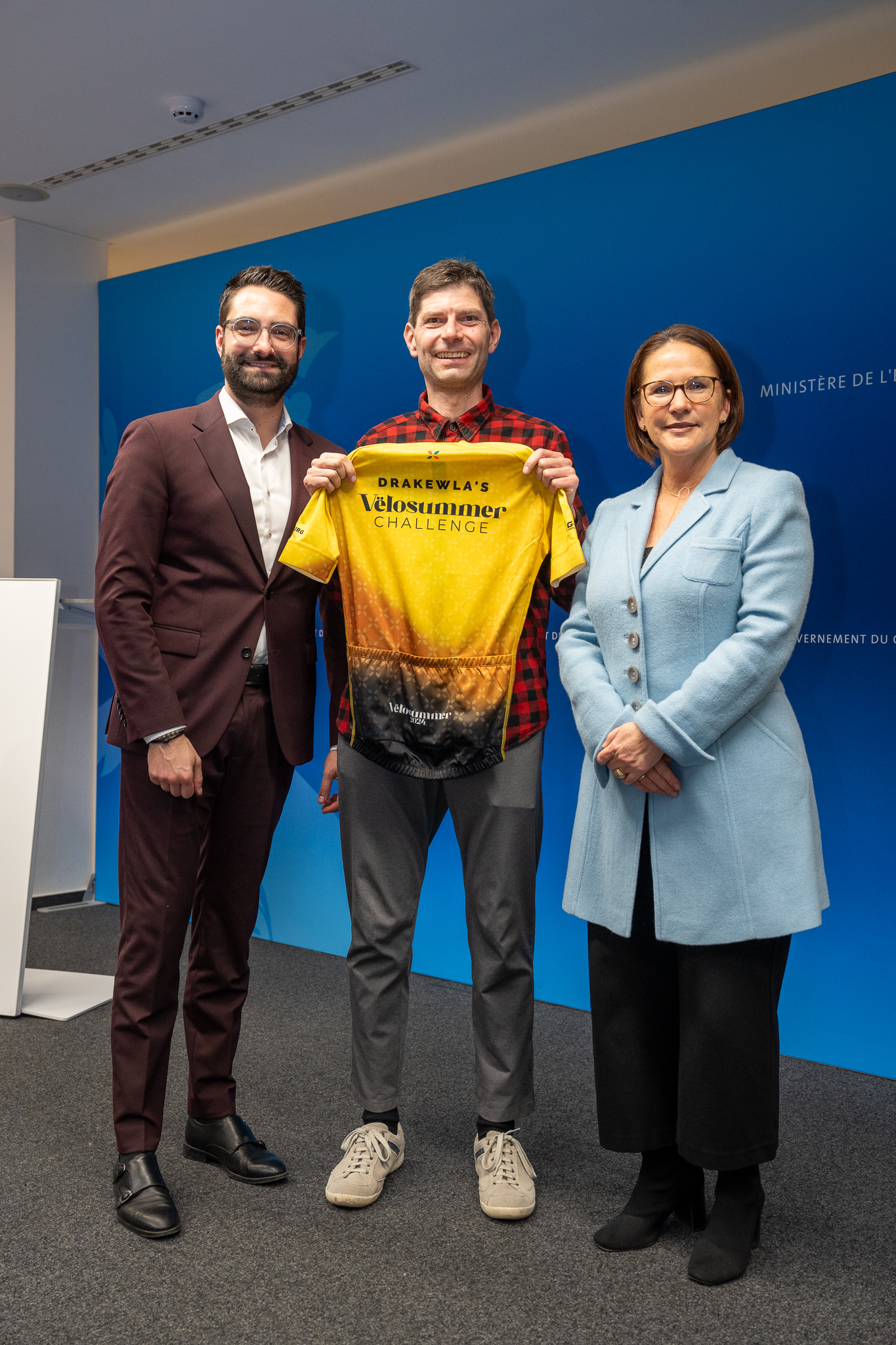
The exchanged friendly smiles turned into some conversations. That was the highlight of the ceremony. I felt proud and grateful to be part of such a passionate cycling community. It was also a great moment to share with the ministers of infrastructure and economy, who were just as excited about cycling as we were. It was a bit surreal to receive our Vëlosummer jerseys so far from the summer, but it made the occasion even more special.

The ceremony also gave me a chance to reflect on the unique spirit of Vëlosummer and how much it has brought people together over the years. From the roads to the jerseys, it’s clear that this event is more than just about cycling; it’s about building a community and sharing the joy of riding. It was a great way to wrap up an unforgettable experience!

Vëlosummer 2024 ceremony photo


GoGoVELO

Short on time for reading? Dive into the pictures instead!

What is GoGoVELO?

GoGoVELO is a cycling campaign initiative brought to you by ProVelo and Climate Alliance Luxembourg, which takes over from MVOS (Mam Vëlo op d’Schaff/Schoul) and Tour du Duerf with the support of the Ministry of Mobility and Public Works. The first campaign ran from September 20 to October 31 under the theme “Around the world in 42 days“, intending to encourage everyone to “use the bike as often as possible as a means of transport in daily life.” To join in, install the “Radbonus II” app and you could win some great prizes! Fun moment: I happened to be visiting ProVelo when they registered the domain name gogovelo.lu.

I didn’t end up winning anything during the challenge, even though I came in at number 2 out of 562 (I’ve heard some buzz that number one is diving into some intensive training to prepare for the famous Race Across America!). Kind of reminds me of The Transcontinental Race where the winner only walks away with a handshake! Still, some friends who cycled a bit less than me and managed to win something surprised me with some lovely gifts 🎁😍.

This week, they shared a heatmap showing where the challengers went cycling, but it seems my traces barely made a mark — looks like I’m the only one who enjoyed playing in the mud over in the Ardennes! 🐷

Media

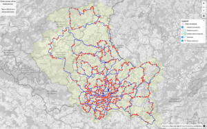
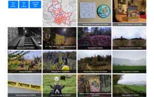
I put together a media gallery featuring photos and videos from the campaign, along with its map. Just a quick note: the distance shown on the map doesn’t match the statistics below since it includes walks but leaves out tunnels (no GPS signal there). Just click or tap on any picture below to get there.

GoGoVëlo map screenshot that shows the photo locations, activity lines and the visited communes.
GoGoVëlo gallery screenshot that shows a filter, a mini map and a preview of the photos and video taken.

Statistics

Overall

  • Total distance: 157,353.82 km (≈ 3.93 round-the-world trips)
  • Total calories: 3,933,845.48 kcal (based on 25 kcal/km)
  • CO₂ savings: 22,658.95 kg

My numbers

  • Total bike rides: 57, active days: 42, distance: 3,111.4 km
  • Total calories burned: 72,296.8 kcal (that’s a lot of pizza slices!)
  • Total elevation gain: 37,438 m (≈ 4.2 times Mount Everest)
  • Total commutes: 16 (190 km)
  • Most active day: Sunday with a total distance of 550 km and an elevation gain of 8,112 m
  • Distance and (elevation) by type of rides:
    • Gravel ride: 2,640 km (32,904 m),
    • Generic ride (on fully paved surface): 468 km (4,502 m),
    • E-bike: 3 km (32 m) 😂.
  • Eddington number (learn more about this):
    • Eddington number (miles): I rode at least 32 miles during 32 days,
    • Eddington number (km): I rode at least 39 km during 39 days.
    • The maximum Eddington possible number during this time period is 42 (whether km or miles)
  • Tiles: I visited 910 unique VeloViewer tiles, out of which 49 were new to me.
  • Average heart-rate: 116.9 bpm.
  • Visited countries: 4; number of activities in each:
    • Luxembourg: 57,
    • Belgium: 14,
    • France: 7,
    • Germany: 7.
  • Gear statistics: distance and (elevation):
    • Sequoia (fully equipped gravel bike): 2,334 km (27,277 m),
    • Citrus (light gravel bike): 606 km (8,460 m),
    • WorldTraveller (trekking bike): 169 km (1,669 m),
    • Vel’Oh (city e-bike): 3 km (32 m) 😂.
  • Weather statistics:
    • Temperature:
      • coldest: October 13 (min. 3℃, avg. 9℃), in a ride named “West hook with a few new tiles (⛅🌤️🌬️🥶)” – 168 km
      • warmest:  September 21 (avg. 22℃), in a ride named “Sauer & Oesling wonderland (☀️)” – 69 km, but parts of the ride on October 21 had some warmer temperature peaks (Saar autumn vibes with summer weather! (🌞; 22,000 km ✔️) – 117 km)
      • average: calculating the average temperature really wouldn’t be meaningful since the average of each ride’s temperature isn’t accurate with all the different distances and duration involved—and honestly, I’m just not motivated to extract each second’s temperature from my raw data.
      • maximum:  publishing the maximum temperature wouldn’t make much sense either, as it’s usually just the bike’s temperature when I kick off my ride or when the temperature probe has been sitting in the sun for a while.
  • Riding costs (based on the price of the bikes, the maintenance and replaced parts – excluding accessories, food and drink supplies):
    • Sequoia:  197.07 EUR – method: I spend (at least) 7900 EUR on this bike and travelled 93,564 km on it (≈ 8.4 cents/km)
    • Citrus: 83.48 EUR
    • WorldTraveller: 13.05 EUR
    • Vel’Oh: 5 cents (one day of the yearly subscription cost to the service)
    • Total: 293.65 EUR (or 9.4 cents/km, which doesn’t include food supplies)
      I used StatsHunters which has a Gear section where you can input your bike cost and maintenance fees.
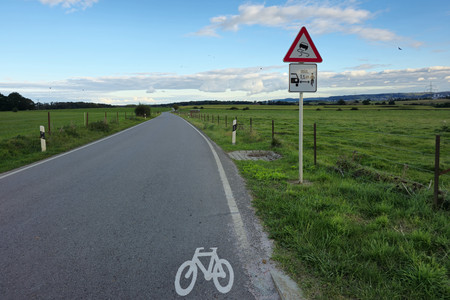
  • Close pass: only one, but located just 200 m after a newly installed sign “minimum 1.5 m lateral distance when overtaking a bike” as displayed on the photo below.

Radbonus II app review

Pros

  • It’s a small company, so when you open a ticket, you’re chatting directly with the engineer, which really helps you appreciate the pressure they’re under when something goes wrong. They shared some fascinating insights with me, like Kalman filters and the challenges of Android development with all that varied hardware.
  • When there was an issue with the app, I could easily share the link to my activity, and they were able to manually import it.

Cons

  • I found the app’s FAQ a bit misleading when it suggests connecting to Google Fit, as that feature isn’t actually implemented. Just as a side note, I noticed that Google Fit only managed to capture about 5% of my Strava activities, so I ended up moving away from it altogether.

  • It can be tricky to remember to start the app alongside the GPS and speed sensor (which is right in front of you) when kicking off a ride—I often recall it after riding for a few kilometres!

  • The Radbonus II app’s internal logging seems to use algorithms that smooth out poor GPS signals, which is why the distance recorded is typically less than what my Garmin shows (averaging about 5 km less each day). The discrepancy in my distance readings decreased a bit since it recorded some walks I forgot to stop, but that didn’t quite close the gap between Radbonus (3054 km) and Garmin (3111 km).

  • While the iPhone app can sync to Health for activity tracking, the Android version doesn’t have that feature. I’ve noticed that the Android logs less distance than the iPhone via Health, which feels a bit unfair for users with a Garmin on an Android phone compared to those using Apple, who can sync their data seamlessly through Apple Health. It would have been great to directly upload a FIT file from a GPS device to the platform, even better for me with a web API call so I could automate the upload when doing the processing of my daily photos.

Room for improvement

It would have been great to have some social events where people could come together to share their experiences and enjoy the scenery, allowing avid participants to connect. Promoting dedicated hashtags on social networks could also have helped build a sense of community. I know that’s easier said than done, especially since ProVelo and Climate Action Luxembourg are small teams, but perhaps companies, public administrations, and local communes could have played a role in initiating the social aspect. Optional small giveaway gifts to promote the action are also a great idea, just like MVOS did. An alternative could be to host a gathering of like-minded individuals; for instance, I would welcome the opportunity to connect with some of my “competitors“.

New day, new adventure