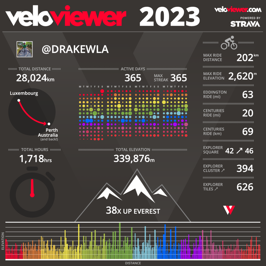
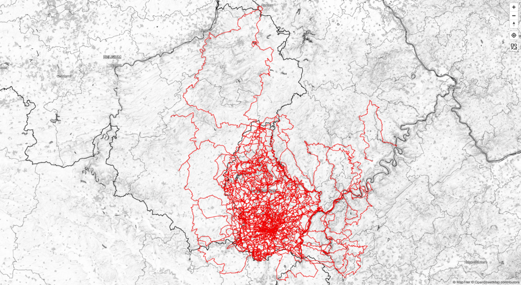
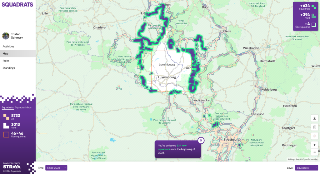
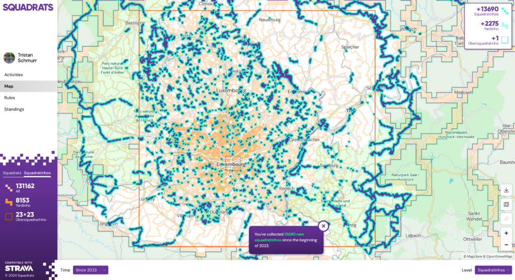
Short on time for reading? Dive into the pictures instead!
What is GoGoVELO?
GoGoVELO is a cycling campaign initiative brought to you by ProVelo and Climate Alliance Luxembourg, which takes over from MVOS (Mam Vëlo op d’Schaff/Schoul) and Tour du Duerf with the support of the Ministry of Mobility and Public Works. The first campaign ran from September 20 to October 31 under the theme “Around the world in 42 days“, intending to encourage everyone to “use the bike as often as possible as a means of transport in daily life.” To join in, install the “Radbonus II” app and you could win some great prizes! Fun moment: I happened to be visiting ProVelo when they registered the domain name gogovelo.lu.
I didn’t end up winning anything during the challenge, even though I came in at number 2 out of 562 (I’ve heard some buzz that number one is diving into some intensive training to prepare for the famous Race Across America!). Kind of reminds me of The Transcontinental Race where the winner only walks away with a handshake! Still, some friends who cycled a bit less than me and managed to win something surprised me with some lovely gifts 🎁😍.
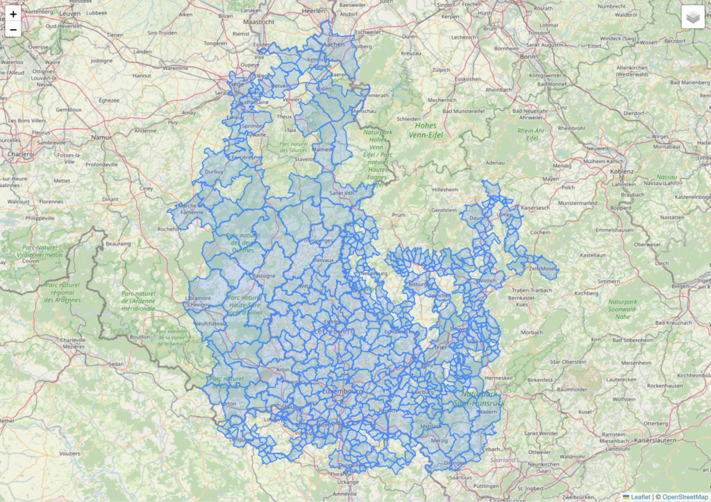
This week, they shared a heatmap showing where the challengers went cycling, but it seems my traces barely made a mark — looks like I’m the only one who enjoyed playing in the mud over in the Ardennes! 🐷
Media
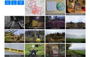
I put together a media gallery featuring photos and videos from the campaign, along with its map. Just a quick note: the distance shown on the map doesn’t match the statistics below since it includes walks but leaves out tunnels (no GPS signal there). Just click or tap on any picture below to get there.
 |
 |
Statistics
Overall
- Total distance: 157,353.82 km (≈ 3.93 round-the-world trips)
- Total calories: 3,933,845.48 kcal (based on 25 kcal/km)
- CO₂ savings: 22,658.95 kg
My numbers
- Total bike rides: 57, active days: 42, distance: 3,111.4 km
- Total calories burned: 72,296.8 kcal (that’s a lot of pizza slices!)
- Total elevation gain: 37,438 m (≈ 4.2 times Mount Everest)
- Total commutes: 16 (190 km)
- Most active day: Sunday with a total distance of 550 km and an elevation gain of 8,112 m
- Distance and (elevation) by type of rides:
- Gravel ride: 2,640 km (32,904 m),
- Generic ride (on fully paved surface): 468 km (4,502 m),
- E-bike: 3 km (32 m) 😂.
- Eddington number (learn more about this):
- Eddington number (miles): I rode at least 32 miles during 32 days,
- Eddington number (km): I rode at least 39 km during 39 days.
- The maximum Eddington possible number during this time period is 42 (whether km or miles)
- Tiles: I visited 910 unique VeloViewer tiles, out of which 49 were new to me.
- Average heart-rate: 116.9 bpm.
- Visited countries: 4; number of activities in each:
- Luxembourg: 57,
- Belgium: 14,
- France: 7,
- Germany: 7.
- Gear statistics: distance and (elevation):
- Sequoia (fully equipped gravel bike): 2,334 km (27,277 m),
- Citrus (light gravel bike): 606 km (8,460 m),
- WorldTraveller (trekking bike): 169 km (1,669 m),
- Vel’Oh (city e-bike): 3 km (32 m) 😂.
- Weather statistics:
- Temperature:
- coldest: October 13 (min. 3℃, avg. 9℃), in a ride named “West hook with a few new tiles (⛅🌤️🌬️🥶)” – 168 km
- warmest: September 21 (avg. 22℃), in a ride named “Sauer & Oesling wonderland (☀️)” – 69 km, but parts of the ride on October 21 had some warmer temperature peaks (Saar autumn vibes with summer weather! (🌞; 22,000 km ✔️) – 117 km)
- average: calculating the average temperature really wouldn’t be meaningful since the average of each ride’s temperature isn’t accurate with all the different distances and duration involved—and honestly, I’m just not motivated to extract each second’s temperature from my raw data.
- maximum: publishing the maximum temperature wouldn’t make much sense either, as it’s usually just the bike’s temperature when I kick off my ride or when the temperature probe has been sitting in the sun for a while.
- Rain:
- Highest precipitation: October 9, in a ride named “Ride under Kirk (🌧️🚿)” – 60 km.
- Wettest body day: September 24, in a ride named “Soaked to the bone in Grünewald (🌧️☔💨)” – 55 km.
- Rides with rain, at least partially: 12 rides on 12 different days.
- Temperature:
- Riding costs (based on the price of the bikes, the maintenance and replaced parts – excluding accessories, food and drink supplies):
- Sequoia: 197.07 EUR – method: I spend (at least) 7900 EUR on this bike and travelled 93,564 km on it (≈ 8.4 cents/km)
- Citrus: 83.48 EUR
- WorldTraveller: 13.05 EUR
- Vel’Oh: 5 cents (one day of the yearly subscription cost to the service)
- Total: 293.65 EUR (or 9.4 cents/km, which doesn’t include food supplies)
I used StatsHunters which has a Gear section where you can input your bike cost and maintenance fees.
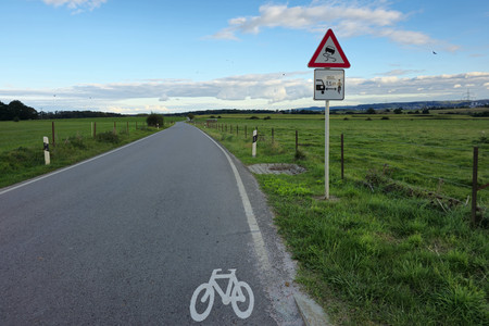
- Close pass: only one, but located just 200 m after a newly installed sign “minimum 1.5 m lateral distance when overtaking a bike” as displayed on the photo below.
Radbonus II app review
Pros
- It’s a small company, so when you open a ticket, you’re chatting directly with the engineer, which really helps you appreciate the pressure they’re under when something goes wrong. They shared some fascinating insights with me, like Kalman filters and the challenges of Android development with all that varied hardware.
- When there was an issue with the app, I could easily share the link to my activity, and they were able to manually import it.
Cons
-
I found the app’s FAQ a bit misleading when it suggests connecting to Google Fit, as that feature isn’t actually implemented. Just as a side note, I noticed that Google Fit only managed to capture about 5% of my Strava activities, so I ended up moving away from it altogether.
-
It can be tricky to remember to start the app alongside the GPS and speed sensor (which is right in front of you) when kicking off a ride—I often recall it after riding for a few kilometres!
-
The Radbonus II app’s internal logging seems to use algorithms that smooth out poor GPS signals, which is why the distance recorded is typically less than what my Garmin shows (averaging about 5 km less each day). The discrepancy in my distance readings decreased a bit since it recorded some walks I forgot to stop, but that didn’t quite close the gap between Radbonus (3054 km) and Garmin (3111 km).
-
While the iPhone app can sync to Health for activity tracking, the Android version doesn’t have that feature. I’ve noticed that the Android logs less distance than the iPhone via Health, which feels a bit unfair for users with a Garmin on an Android phone compared to those using Apple, who can sync their data seamlessly through Apple Health. It would have been great to directly upload a FIT file from a GPS device to the platform, even better for me with a web API call so I could automate the upload when doing the processing of my daily photos.
Room for improvement
It would have been great to have some social events where people could come together to share their experiences and enjoy the scenery, allowing avid participants to connect. Promoting dedicated hashtags on social networks could also have helped build a sense of community. I know that’s easier said than done, especially since ProVelo and Climate Action Luxembourg are small teams, but perhaps companies, public administrations, and local communes could have played a role in initiating the social aspect. Optional small giveaway gifts to promote the action are also a great idea, just like MVOS did. An alternative could be to host a gathering of like-minded individuals; for instance, I would welcome the opportunity to connect with some of my “competitors“.